Public Works, that is. Photographs and Research Documenting our Industrial Heritage. Includes Field Notes with Archival Quality Photographs and Cartographic Studies.
Datum. The Principle of Datum in Architecture and Settlement Planning. The Principles of Architecture. Presentation Number Four.
What is a Datum?
A datum is a feature around which other elements are built or organized. The datum organizes an otherwise random collection of forms through regularity, a visually continuous form, and sufficient size. A datum may be human-built or a natural form.
A datum is a fundamental reference framework used to define positions of features on the Earth’s surface. These measurements help us map geographical features such as rivers, streets, and bridges. Datums are established based on a network of precisely surveyed control points known as benchmarks. Latitude and longitude are part of the geographic coordinate system used to measure and communicate positions on the Earth.
Datum in Natural Forms and Urban Planning. Marking and Mapping Interfaces with Nature.
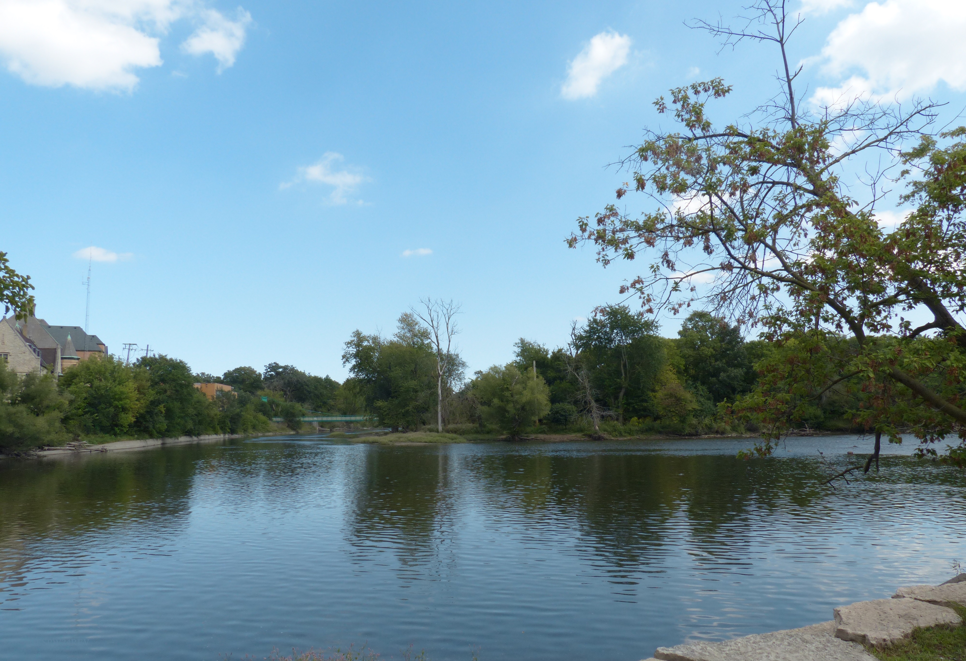
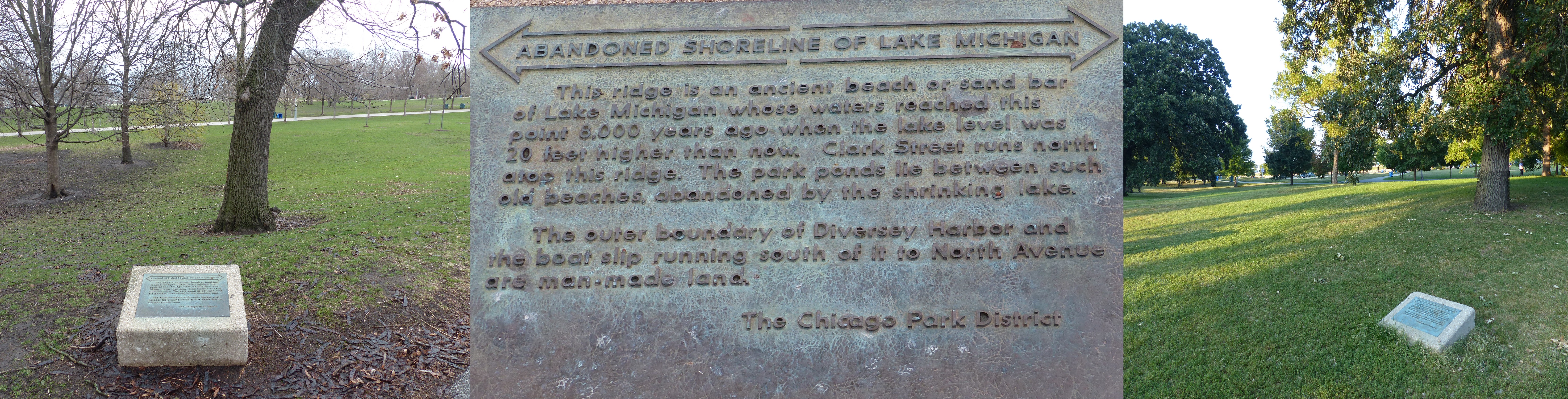
The Des Plaines River is considered a natural datum. It flows 133 miles through Southern Wisconsin and Northern Illinois. The river served tribes for transportation and now is a recreational venue for boaters and fishers. The river could serve as a natural divider for the development of the area of Riverside and the nearby village of Lyons. Its course influenced the layout of the village and defines the landmark landscape planning of Frederick Law Olmsted and Vaux and Company. The river is a boundary for the Riverside Landscape Architecture District. In the photo, the river winds gently past the Riverside Public Library, Village Hall, and Police Department. Left: This marker for the abandoned shoreline of Lake Michigan is on the east side of North Stockton Drive and north of West LaSalle Drive. The marker’s top edge is towards the southeast and Lake Shore Drive.
Center: The text on the shoreline markers.
Right: This abandoned shoreline marker for Lake Michigan is west of the recreation courts in Lincoln Park and along North Stockton Drive. It’s top edge lines along Lake Shore Drive.
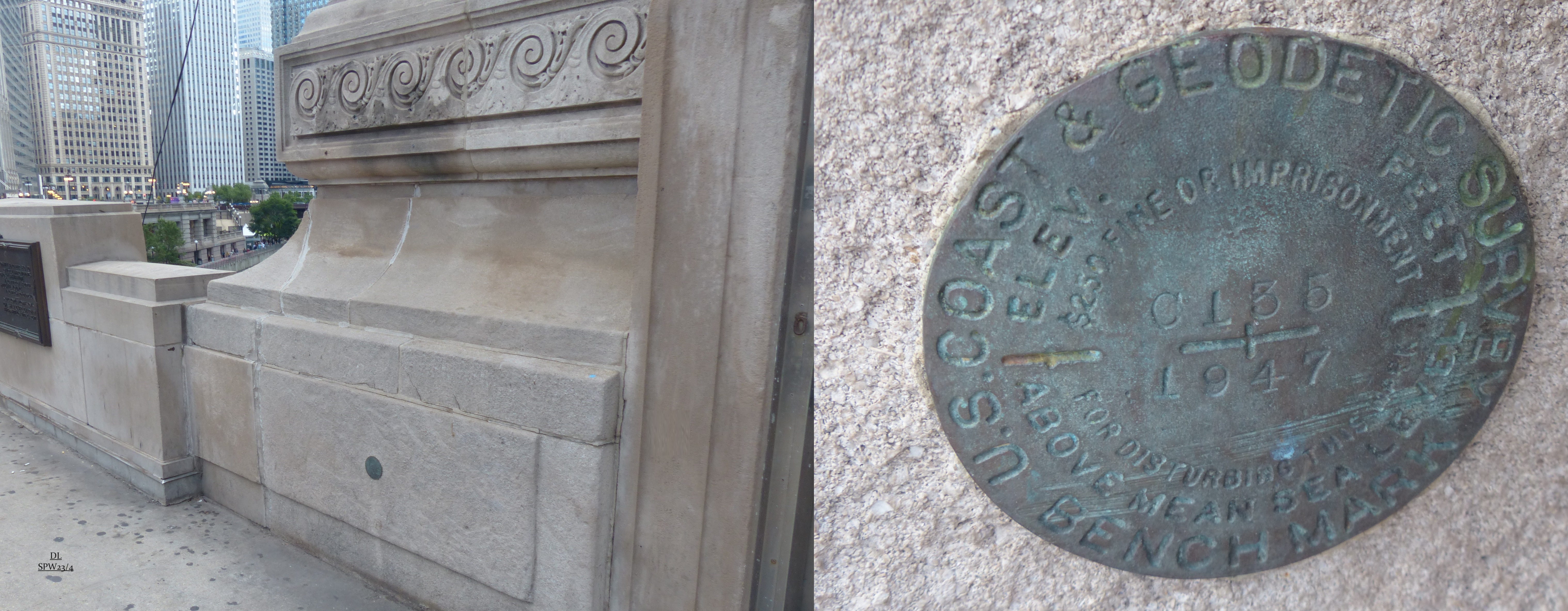
Datum Measurements and Markers.
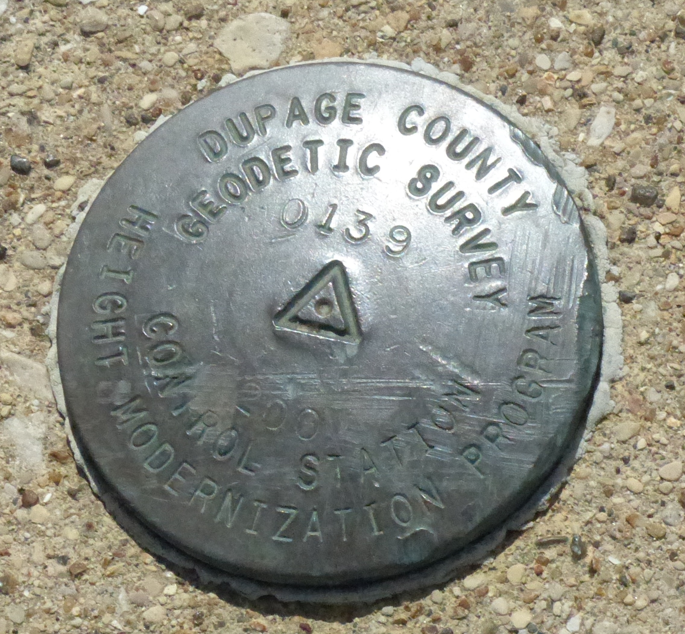
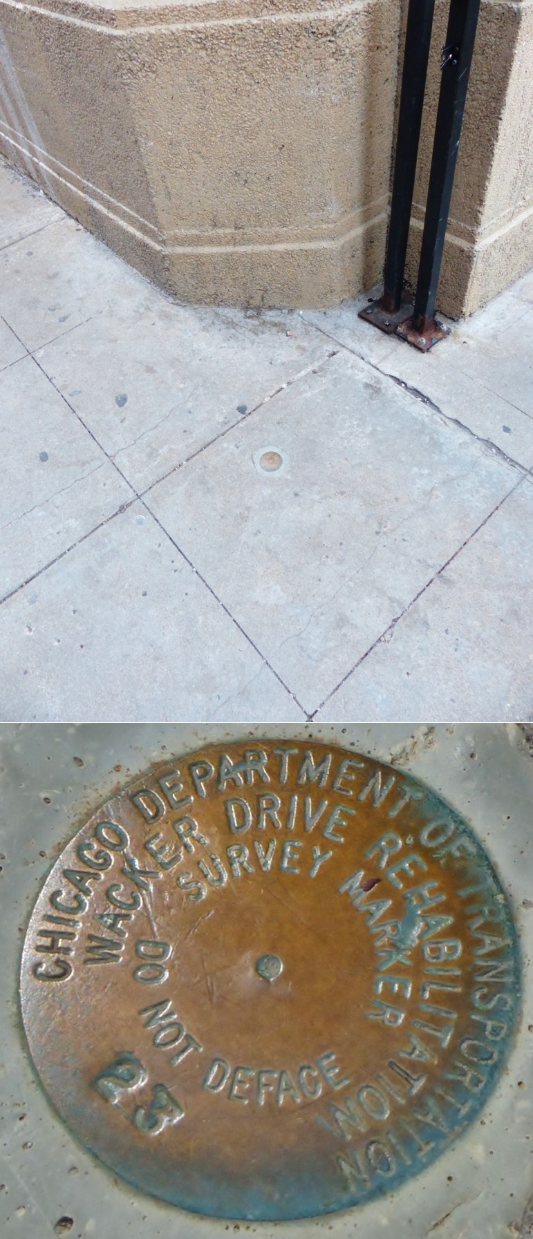
This detailed geodetic survey marker is detailed with the following information: location (DuPage County), purpose (Geodetic Survey Control Station Height Modernization Program), and designation (0139). The center symbol of a triangle with a dot in it is oriented so that a surveyor’s plumb bob dropped over this dot will ensure precise location. Chicago Department of Transportation Wacker Drive Rehabilitation Survey Marker 23 includes a dot in its center. Survey markers such as these are used to indicate specific points that have been precisely measured and recorded.This USC & G benchmark designated as C135 1947 places coordinates of this part of the DuSable Bridge at 41° 53 21.2 North and 087° 37 27.4 West and its elevation at 617.32 feet.